In part 1 of this topic we covered apps that measured directions, distances and trim. This time, we cover apps that convert measurements and perform calculations made onboard and a couple of apps that display readouts otherwise done by conventional instrument displays. As before, here are the main features; look to their Google Play Store download listing for more details and features.
“How Much is That in XXX?”
Sometimes, doing electrical work, installing hardware, storing liquids or checking other measures, data is in “whatchamacallits” and we really need it in “thingamabobs”. Sure, there are tables and reference books down in the chart table (or, on my boats, “back on some shelf at home.”) Luckily, there are look-up converters for Android. One that I find both dirt-simple yet comprehensive is CONVERTER PRO. With 17 categories of conversions, it covers almost everything anyone could ever need. Type a “from” value and the “to” equivalent magically appears. Change either measure and it re-calculates.
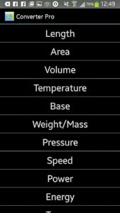
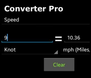
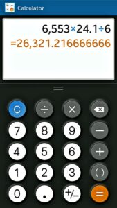
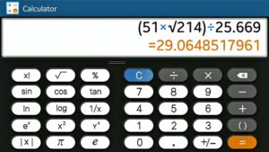
It can’t get much simpler. While on the subject of calculations, many aspects of traditional navigation require straight-forward 5-function arithmetic. Do yourself a favor; find a solid free calculator app to have on your device. There are many but I chose Calculator. Held in Portrait Mode, it is a 4-function calculator; turn it to Landscape mode and you get access to square roots and full trig functions/scientific notation. Choose what works for you.
“Helm!! Mind Your Head!”
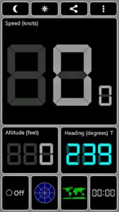
That is the traditional command by the Officer of the Deck or Captain reminding the helmsman to carefully monitor their course. Well-equipped, well-maintained vessels often have a properly-adjusted binnacle-mounted or bulkhead compass and functioning electric knotmeter for the helmsman. Back in the real world, the knotmeter is often the first gear to malfunction. Compasses are often far out of alignment, never installed, leaking fluid or obstructed from view. What to do? Luckily, programmers who gave you the Field Compass + have another clever application called GPS Test Plus. This little multitasker’s main trick (for me, at least) is to provide a simple, dynamic “dashboard” display with current speed (in Knots or other units) & heading. This info is derived from GPS and not from that weed-clogged knot sender. (It also shows altitude if you were on land or flying.) One tap gets you a compass display, night mode, satellite display, Day/Night world map, HUD mode, Sunrise/Sunset info, and a spot for quick notes on location & time, if needed. Like all of their apps, there are many options for setup, colors, units, etc to make it suit your needs and likes.
Another display app, which is clever but limited by the hardware on your vessel, is the free RayViewer repeater display for RayMarine integrated instruments. IF you are on a vessel with an ultra-modern WiFi-enabled Raymarine electronics package, this app links up and acts as a one-way repeater to display nav data on your smartphone or tablet. The company itself sells a commercial Android (and iOS) app that is two-way, both displaying data and accepting commands/settings from your device to the system.
Bonus for Environmentalists and Science Geeks:
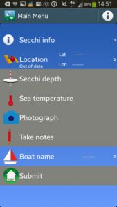
Marine scientists at Plymouth University are world leaders in research on the health of the oceans and, thus, the entire world environment. One of the key clues to monitoring changes in the oceans’ condition is the study of phytoplankton. (It provides 50% of all photosynthesis on Earth and is the base of virtually the entire marine food chain.) There is a quick and easy method to monitor the levels of plankton call the “Secchi Disk”. It is a 30 cm wide, weighted white disk which is lowered in seawater until you no longer see it. (The plankton obscure it.) An attached measuring tape is used to note the depth where it disappears. Depending only on professional survey crews for measurements grossly limits seasons, frequencies, and geographic range of the data. SecchiDisk.org encourages sailors to assemble their own Secchi disk and make observations, wherever they are, whenever they are afloat. This program greatly aids worldwide ecological research efforts. The special app, SECCHI lets amateur observers record data and the app automatically feeds it back to the research institutions. When you are out of range of WiFi or cellphone, the app stores successive readings then uploads them when next in range. We all love the oceans, here is a way to help care for them. Kids would love being given the task of doing this.
Android App Download Links
 |
Unit Converter Pro | FREE |
 |
Calculator | FREE |
 |
GPS Test | FREE |
 |
SECCHI | FREE |
Note to all sailors looking to purchase: Read all instructions, manuals, tips, and reviews for any new app. There are often FREE versions of many of these apps with some slight limitation on features. The authors hope you upgrade (1) for the extra features, (2) to remove the ads, or (3) to show gratitude to the developers. Any app with the words “Pro”, “Plus” or “Premium” at the end is likely a paid version. In the Android world, with rare exceptions, this means a cost of $0.99 to $4.00. This is truly small change to reward those smart people who do such very nice things for you. (Ask your Apple friends what they have to pay for apps!) I usually test an app and, for reason (3), I upgrade if I decide to keep it.
Captain Lan Yarbrough is a USCG Master and an ASA instructor for over 25 years. He has sailed the U.S. and Mexico and in the Caribbean, Mediterranean and Red seas. He has published many sailing articles and helped write ASA 101 and 103 textbooks.

