
Does the maze of technology and different navigation apps confuse you about which ones are best? And where does their data come from? We will help you decide what’s best for your boating adventures.
Today’s technologies can be baffling. There is more functionality than ever with seemingly unending choices for navigation platforms and apps. Our training team puts into simple terms what you should know when making decisions about what equipment you should use. Are you a day sailor? Or a charter captain? We will show you the options.
REGISTER NOW

ONLINE COURSE OVERVIEW
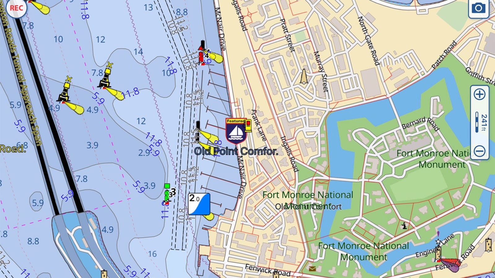
This online class takes you step-by-step through the recent developments in mobile navigation applications, data sources, cartography, and trends. Using a series of images, extracts, and data from the world’s leading cartographers and app developers, you will see how mobile apps differ, where data and information originate, and how you can make decisions about which technologies will assist in keeping you safe and aware when on the water. Mobile apps and Electronic Nautical Charts (ENC) including Navionics, Aqua Map, Raymarine, C-Map, Garmin, Argo, and others will be explored.
Who is this online class for?
This online class is geared toward beginner sailors, coastal cruisers, and offshore adventurers who want to know how today’s cartographers and ENC designers are adapting and delivering accurate charts. Knowing where data comes from, and how often it is refreshed, will be presented during the exploration of the topic.
What Will I Learn?
You will learn about recent trends in the creation of vector data, how ENC designers use the data, which mobile applications are dedicated to consistent refresh schedules, how Hydrographic Offices worldwide are adapting their architecture to accommodate data distribution, and how to develop a checklist of what’s important to you when making a decision about which ENC(s) to use.
List of Topics:
- Transitioning from paper charts to electronic charts
- Where does the data originate
- How is data distributed
- Why do different charts use different colors
- How many mobile apps are there
- What makes a chart plotter different than a mobile app
- Who do you trust for your information
- How to transfer tracks and routes among devices as .gpx files
- How can I learn it all
Navigate with Today’s Marine Technologies
Choose Your Tools
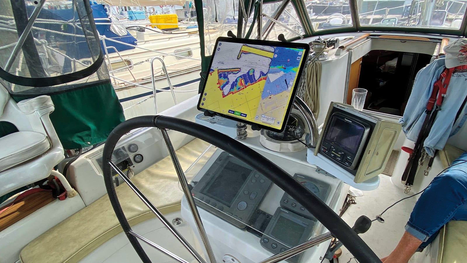
Modern navigation doesn’t have to feel overwhelming. This online class breaks down today’s chart plotters and mobile navigation apps so you can understand how they work, where their data comes from, and how to use them confidently on the water—whether you’re day sailing or heading offshore.
Navigation Technology, Made Clear
Ed Tillett walks you through the essentials of electronic navigation, from mobile apps to dedicated chart plotters. Using real-world examples, you’ll explore how charts are created, why apps differ, how often data is updated, and what matters most when selecting tools you can trust.
A Smarter Way to Navigate
This online class focuses on clarity and confidence: understanding ENC data sources, comparing platforms, transferring routes, and knowing which technologies best support your sailing style. With expert insight and practical guidance, you’ll gain the awareness needed to navigate safely and make informed decisions every time you leave the dock.
YOUR HOST
ED TILLETT
Ed Tillett is a lifelong sailor, yachtsman, and explorer. As editor-in-chief of Waterway Guide Media, his background in instructional design and media have served to help transition the 80 year old publishing company into a leading provider of information and content that promotes safe boating, travel, and adventure. His informative and lively treatment of the topics offer an easy to understand and meaningful experience for Attendees.
ONLINE CLASS REGISTRATION
@ 4:30 PM PT / 7:30 PM ET (90 min)
Regular Price
$39
ASA Member Price
$29
ON-DEMAND ACCESS
All registrations include unlimited on-demand access to the recordings of the live online class. So if you are unable to attend live you can still register and watch at your leisure.
ASA MEMBER DISCOUNT
American Sailing Members can claim their discount in the Member Portal. If you're not a current member, then for only $59/year you can join or renew today!
This site is protected by reCAPTCHA and the Google
Privacy Policy and
Terms of Service apply.