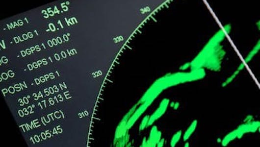
Course OVERVIEW
Nothing beats radar for guiding your boat through the darkest night or the thickest fog. Radar enables you to plot a fix from just a single buoy or landmark, and it is the only navigation tool that tells you not just where you are, but who else and what else is out there with you.
The ASA 120, Radar Endorsement Course covers all aspects of practical radar usage needed to get underway. Learn how to properly and accurately navigate your vessel while underway and how to avoid any potential collisions at sea.
» HOW RADAR WORKS.
Discover the principles of radar and how it works as well as an overview of system components:
- ‣ Microwave pulse and beam structure
- ‣ Radar target characteristics
- ‣ Range of detection, scanner design, and mounting options
- ‣ Power requirements
- ‣ Radiation safety near radar scanners
» RADAR OPERATION.
Learn basic radar operation:
- ‣ Turning on, warming up, and initial adjustments
- ‣ Gain adjustments
- ‣ Use of anti-clutter controls for rain (FTC) and sea state (STC)
- ‣ Pros and cons of optional display modes: Head-up, North-up, and Course-up
- ‣ Optimizing pulse-length selection
- ‣ Measuring target range and bearing with VRM, EBL, and cursor mode
- ‣ Use of guard sectors and alarms
» INTERPRETING THE SCREEN.
Reading radar forecasts and how to optimize for specific observations:
- ‣ Radar shadows
- ‣ Effect of horizontal beam width on target images
- ‣ Effect of pulse length on target images
- ‣ Identifying interference and other unwanted echoes
» POSITION NAVIGATION.
- ‣ Coordinating electronic chart displays with the radar screen
- ‣ Quick radar range and bearing confirmation of GPS positions
- ‣ Accurate multi-range fixes using radar
» PILOTING.
Use of radar when piloting a vessel:
- ‣ Use of radar to hold a desired course
- ‣ Use of electronic range and bearing line (ERBL)
- ‣ Finding and keeping track of position relative to prominent landmarks
- ‣ Identifying distant harbors or channels
- ‣ Rounding a corner at a safe distance off
- ‣ Anchoring with radar
» RADAR AND THE NAVIGATION RULES.
Use of radar position for navigation and coordinating with electronic charts:
- ‣ Role of radar in evaluating risk of collision
- ‣ Cautions (limitations) for radar use cited in the rules
- ‣ Rules' requirements for checking various ranges and adjustments
- ‣ Application of Rule 19d — when detecting a converging target by radar alone
» COLLISION AVOIDANCE.
Utilizing radar for collision avoidance:
- ‣ Use and value of target trails and wakes
- ‣ Tracking targets with EBL and VRM
- ‣ Estimating time, range and bearing to closest point of approach (CPA)
- ‣ Figuring true course and speed of approaching targets (relative motion diagram)
- ‣ Determining expected running lights based on radar observations
- ‣ Rules of thumb for radar maneuvering
- ‣ Radar reflectors
- ‣ Overview of ARPA and AIS
COURSE LENGTH & PREREQUISITES
You can reasonably expect to spend approximately 30 hours on this course, depending on how much optional material you choose to cover. Once enrolled, students can start the course at any time with access to the full set of lessons - including quizzes, reading materials, and slides. With the ability to start immediately and submit quizzes and discussion topics at any time (day or night), you will have the freedom to work at your own pace and time schedule.
COURSE ACCESSIBILITY
The electronic components of this course allow you to take it with you anywhere! Take it with you as you travel, or use it as a resource to search the complete set of materials for specific topics. If you prefer to work on your own without computers, you will have a complete syllabus with practice exercises and answers in the printed materials. For added structure to your training, take part in the online discussions and individual quizzes for each lesson.
COURSE MATERIALS - WHAT'S INCLUDED
COURSE MATERIALS
All necessary materials are provided to complete the online course, including textbooks (Radar For Mariners), Radar Trainer PC simulator program. and a complete online study course.
INSTRUCTORS & DISCUSSION GROUPS
Each Starpath course includes free access to online resources and discussion groups. Starpath has instructors in three different time zones monitoring these groups so, should any question arise, simply post it in the Student Discussion Forum for a quick answer — or search the forum to see if an answer to your question already exists.
ASA Certification
A certification & seal for your logbook.
1 year access
You have one year to complete the course or request an extension.
Other Starpath Courses
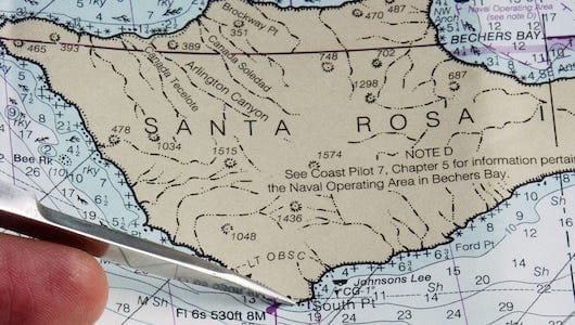
ASA 105
Coastal Navigation
Learn practical navigation on inland and coastal waters, including chart reading, piloting, and more.
ASA 107
Celestial Navigation
Learn practical celestial navigation and other aspects of safe ocean navigation.
ASA 117
Basic Celestial Endorsement
Learn to apply basic celestial navigation theory and to determine latitude and longitude at sea.
Please register for one or more of the Starpath courses below.
If you have any questions contact support@americansailing.com

